Mill Creek is a polluted and heavily channelized stream flowing through the industrial corridor of the Mill Creek Valley in Cincinnati OH. The creek is a classic underfit stream, flowing in a large valley that once held a much bigger north-flowing river
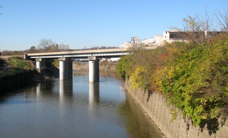 |
View from Clifton Ave bridge over Mill Creek looking downstreamImages of Mill Creek |
|---|
during the deep-stage glacial episode. The deep-stage valley was 150 or so feet deeper than the present valley floor (see cross-section). The subsequent fill is largely sand and gravel, and forms an important ground-water supply.
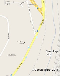
In a 1999 Senior Thesis, Heather Freeman investigated the heavy metal content of Mill Creek alluvium. She found that, below about 20 cm, the sediments were highly enriched in Pb and Zn, up to 20 times background. Cr and Cu were also somewhat enriched, presumably the result of industrial releases over the past 200 years.
Full report (pdf format)
Data tables (spreadsheet)
Sample Location
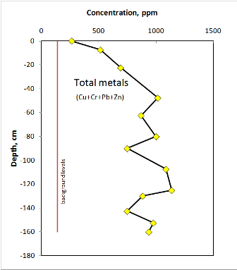
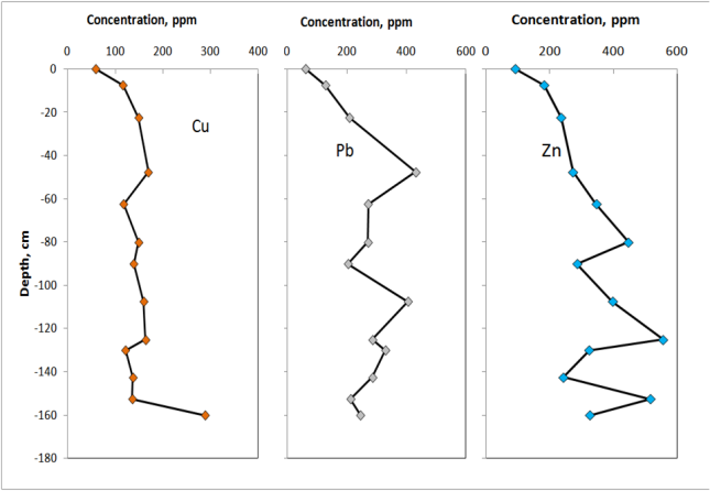
Her data are similar to those reported by the Ohio EPA from their survey of bottom sediments in the creek. They took grab samples at various locations from the mouth to the headwaters. As shown in the graph below, the area around St Bernard and Northside is particularly high in heavy metals and the values are similar to the maximum found in the stream bank alluvium studied by Freeman and in the canal ponds.
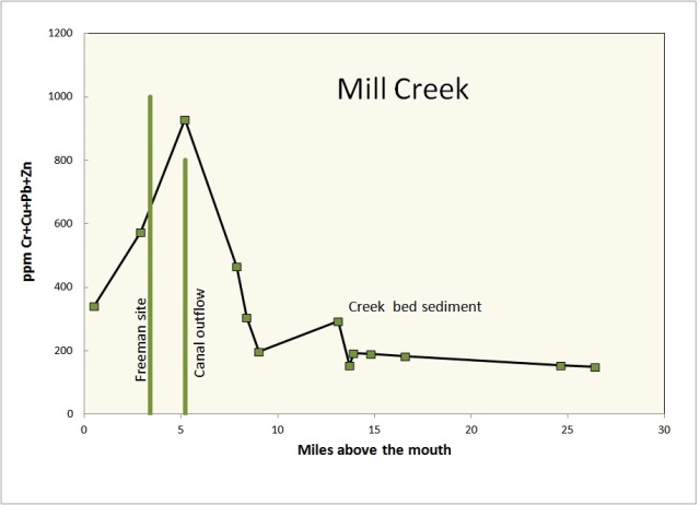
Ohio EPA, 1994, Biological and Water Quality Study of Mill Creek And Tributaries Butler and Hamilton Counties, Ohio. Volume 1.OEPA Technical Report SWS/1993-12-9. [data table] [full report pdf]