The paths of destruction

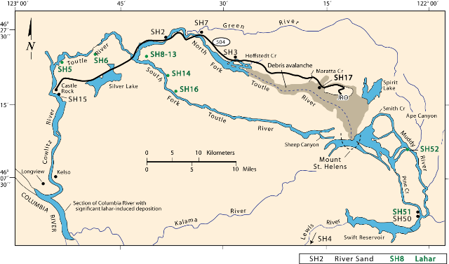
Map showing lahar pathways (A) to the south via the Muddy River and Pine Creek into the Lewis River and (B) to the west via the north and south forks of the Toutle River into the Cowlitz and ultimately into the Columbia River.
The numbers are sampling localities for a study comparing alluvium and lahar compositions and testing discrimination of sands from different Cascade volcanoes.
Muddy River and Pine Creek lahars (under construction)
North Fork lahars and Debris Avalanche
Map Source
Janda, R.J., Scott, K.M., Nolan, K.M., and Martinson, H.A., 1981, Lahar movement, effects, and deposits, in Lipman, P.W., and Mullineux, D.R., eds., The 1980 Eruptions of Mount St. Helens, Washington: U.S. Geological Survey Professional Paper 1250, p. 461-478.